
Classification of Tier 1 cities in India by their economic, social and infrastructural development .
Let us see some of the factors that determine a particular city, how its classified and which tier it belongs to
Criteria for Tier 1 city :
- Population – should be greater than 5 million people (>5 million) = (> 50 lakh people )
- GDP – should be greater than 20 billion dollars ((20 billion$ =2000 crore $ = (1,64,000 crores) means (> 1.64 lakh crores)
- Advanced infrastructure – Metro, Airport, Seaport, Strong IT, Manufacturing, Service sectors.
- Standard of living – Costly (lifestyle)
Now lets us see how many Metropolitan cities are there in India
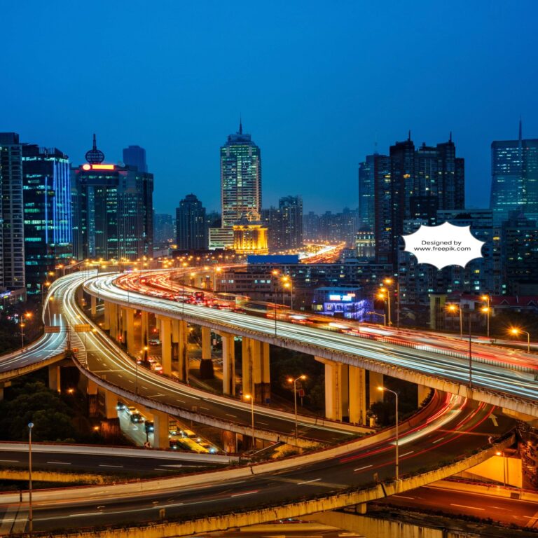
1. BANGALORE :
Bangalore is the capital city of Karnataka state, also called as (Silicon Valley of India) or (IT Capital of India)
We have 8 Tier 1 cities in India, bangalore is one of them
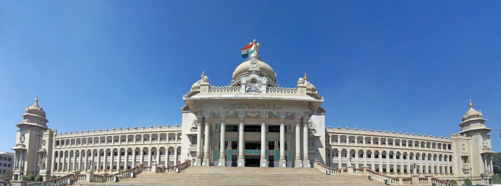
https://en.wikipedia.org/wiki/Bengaluru#/media/
File:Vidhana_Soudha_2012.jpg
Image credit: Muhammad Mahdi Karim & Mydreamsparrow,
Own work, licensed under GFDL 1.2.
- Name – BENGALURU (official), BANGALORE (commonly)
- Location -Karnataka, South india
- Population -1,40,08,000 (approx)
- Area – 741 km2 (286 sq mi)
- Languages spoken – Kannada(official), English, Hindi, Tamil, Telugu
- Timezone – IST (UTC+5:30)(UTC means coordinated universal time similar to GMT)
- History – Founded by Kempe Gowda (1537),Cantonment established in 1806(british colonial era)
Bangalore – Infrastructure :
- GDP – 300 billion dollars (GDP means gross domestic product,means the total value of all final goods and services produced and sold in market typically in a year. )
- Key sectors – IT, Manufacturing, Services, Agriculture
- IT – (40%)(related to information technology, software related)
- Manufacturing – (25%)(food products, beverages, textiles, leather products etc..)
- Services – (20%)(banks ,hotels, real estate, education etc..)
- Agriculture -(15%)(growing field crops, fruits, nuts, vegetables etc..
- Major industries – Software, Aerospace, Biotechnology, Automobile
- Unemployement rate – 2.4%(2022-23)
- Literacy rate – 88.61%(2024)
- Airport – Kempa Gowda International Airport (BLR)
- Metro – Namma Metro (42 km network)
- Railway stations – Bangalore City Railway Station(SBC), Bangalore Cantonment Railway Station(BNC) Yeswanthpur junction(YPR), Krishnarajapuram Railway Station(KJM), kengeri(KGI) and few more, Total stations are around 15.
- Roadways – National Highways ( 4,7,48,75,275,844,948,766)
- Public transport – BMTC buses, Taxis, Auto rickshaws, Cycle rickshaws.
- Universities– Bangalore University, Christ University, Visvesvaraya technological University, University of Agricultural Sciences Bangalore and more (Total around 16 universities more)
- Institutes – Indian Institute Of Science (IISc), Indian Institute Of Management (IIMB) and many more institutes
- Hospitals – Apollo Hospital, Fortis Hospital, Manipal Hospital
- Medical Research -National Institute Of Mental Health and Neurosciences (NIMHANS)
- Health care infrastructure – 2500+ hospitals, 1500+ clinics
- Landmarks – Vidhan Soudha, bangalore Palace, Lalbagh Botanical garden
- Administrator – Mayor, Commissioner
- Municipal Corporation – Bruhat Bengaluru Mahanagara Palike (BBMP)
- Climate – Tropical Savanna climate
- Temperature range – 15 degrees (winter) to 35 degrees (summer)
- Monsoon season – July to September
- Population Density – 11,000/km square
- Challenges -Air pollution, over population, water scarcity, waste management, traffic congestion
2. DELHI :
Delhi is the capital city of India, mix of traditions, also served as capital for ancient rulers in india
We have 8 Tier 1 cities in India, Delhi is one of them
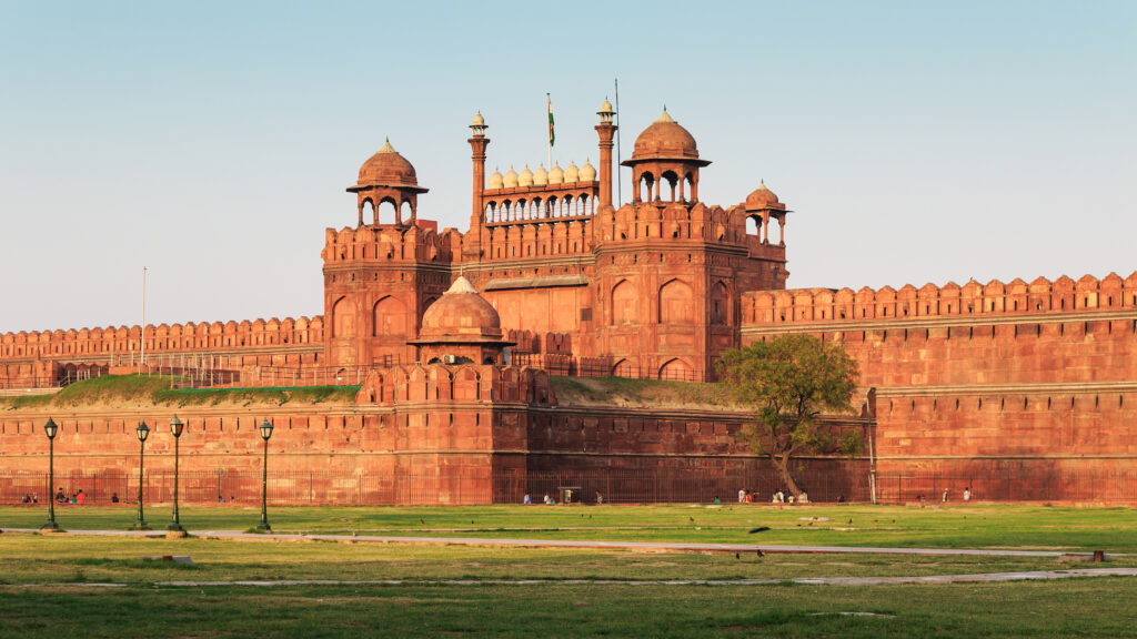
https://en.wikipedia.org/wiki/Delhi#/media/
File:Red_Fort_in_Delhi_03-2016_img3.jpg
Image credit: A.Savin, Own work, licensed under FAL.
- Name – DELHI
- Location – North central part of India
- Population -3,38,07,000 (approx )
- Area -1484 kilometer square (573 square meter)
- Languages spoken -Hindi, English, Urdu, Punjabi
- Time zone -IST (UTC+5:30)(UTC means coordinated universal time similar to GMT)
- History -ancient city,inhabited since 6th century BCE
- Historical importance – Served as capital for empires – Tughlaq ,Mughal , British
Delhi – Infrastructure :
- GDP – 272 billion dollars (GDP means gross domestic product,means the total value of all final goods and services produced and sold in market typically in a year. )
- Key sectors – Services, Manufacturing, Agriculture
- Services -(75%) (everything other than agriculture and manufacturing comes under service sector)
- Manufacturing – (22%)(manufacturing of machines ,electronic products etc .. )
- Agriculture – (3%)(growing of crops, fruits, tea, coffee etc..)
- Major industries – IT(information technology), Healthcare, Finance, Tourism.
- Unemployment rate – 9.66% (2023)
- Literacy rate – 86.21% (2024)
- Airport – Indira Gandhi International Airport (IGIA)
- Metro – Delhi Metro (373 km network)
- Railway stations – New delhi(NDLS), Hazrat nizamuddin(NZM), Delhi junction(DLI), Delhi sarai rohilla(DEE), Anand vihar terminus(ANVT), and 43 more stations,(total 48 stations) in delhi.
- Roadways – National Highways ( 1, 2, 8, 10, 24 )
- public transport – DTC buses, Taxis, Auto rickshaws, Cycle rickshaws.
- Universities – Delhi University, Jawahar Lal nehru University, Jamia Millia Islamia University are some of top universities in delhi and more (Total 30).
- Institutes – IIT delhi, AIIMS, Indian Institute of Foreign Trade and many more
- Hospitals – AIIMS, Safdarjung hospital, Apollo Hospital
- Medical Research – National Institute Of Immunology, Institute Of Genomics and Integrative biology
- Health care infrastructure – 3500+ hospitals, 1500+ clinics
- Landmarks – Red fort, Qutub minar, India Gate, Humayuns tomb
- Administrator – Lieutanant Governor
- Muncipal Corporations – North,South,East Delhi Municipal Corporations
- Climate – Humid subtropical climate
- Temperature range – 2 degrees (winter) to 45 degrees (summer)
- Monsoon season – July to September
- Population density – 11,312/km square
- Challenges -Air pollution, over population, water scarcity, waste management, traffic congestion
3. CHENNAI :
Chennai is the capital city of Tamilnadu state, also known as Gateway of South India.
We have 8 Tier 1 cities, Chennai is one of them
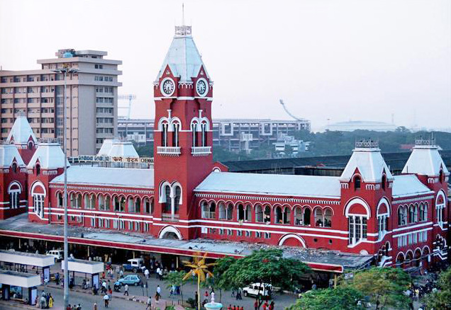
licensed under CC BY-SA 2.0.
Chennai Central Railway station (Chennai)
https://en.wikipedia.org/wiki/Chennai#/media/
File:Chennai_Central.jpg
- Name – CHENNAI (formerly Madras)
- Location – Tamilnadu, South India
- Population – 1,22,90,000 (approx )
- Area – 426 km2 (164 sq mi)
- Languages spoken – Tamil (official), English, Telugu, Hindi
- Timezone – IST (UTC+5:30)(UTC means coordinated universal time similar to GMT)
- History – Founded by British East India Company (1639), Madras Presidency(1640-1947) (British colonial era)
Chennai – Infrastructure :
- GDP – 143 billion dollars (GDP means gross domestic product,means the total value of all final goods and services produced and sold in market typically in a year. )
- Key sectors – IT, Automotive, Services, Manufacturing
- IT – (35%)(related to information technology, software related)
- Automotive – (25%)(manufacturing of vehicles 2-wheelers, 3-wheelers,passenger cars, light commercial vehicles, trucks, buses, tractors, heavy commercial vehicles)
- Services – (20%) (everything other than agriculture and manufacturing comes under service sector)
- Manufacturing – (20%)(manufacturing of machines ,electronic products etc .. )
- Major industries – Software, Hardware, Automobile, Textiles
- Unemployement rate – 4.7% (2023)
- Literacy rate – 90.3 % (2024)
- Airport – Chennai International Airport (MAA)
- Ports – Chennai port, Ennore port
- Metro – Chennai Metro (45 km network)
- Railway Stations – Chennai Railway Station, Egmore Railway Station (total over 40)
- Roadways – National Highways (4, 5, 45, 48,)
- Public transport – MTC buses, Taxis, Auto rickshaws, Cycle rickshaws.
- Universities – University of madras, Anna University and 6 more (total 8)
- Institutes – IIT madras, Indian Institute of Management(IIMC) and many more
- Hospitals – Apollo Hospital, Fortis Hospital, Sri Ramachandra Medical Centre
- Medical Research – National Institute Of Epidemiology, Institute Of Microbial Technology
- Health Care Infrastructure – 3500+ hospitals, 1500+ clinics
- Landmarks – Marina Beach, Fort St.George, Kapaleeswarar temple
- Administrator – Mayor, Commissioner
- Muncipal Corporations – Greater Chennai Corporation
- Climate – Tropical wet and dry climate
- Temperature range – 20 degrees (winter) to 40 degrees (summer)
- Monsoon season -June to September
- Population density – 16,000/km square
- Challenges – Air pollution, over population, water scarcity, waste management, traffic congestion
4. MUMBAI :
Mumbai is the capital city of Maharashtra state, also known as financial capital of india
We have 8 Tier 1 cities in India, Mumbai is one of them
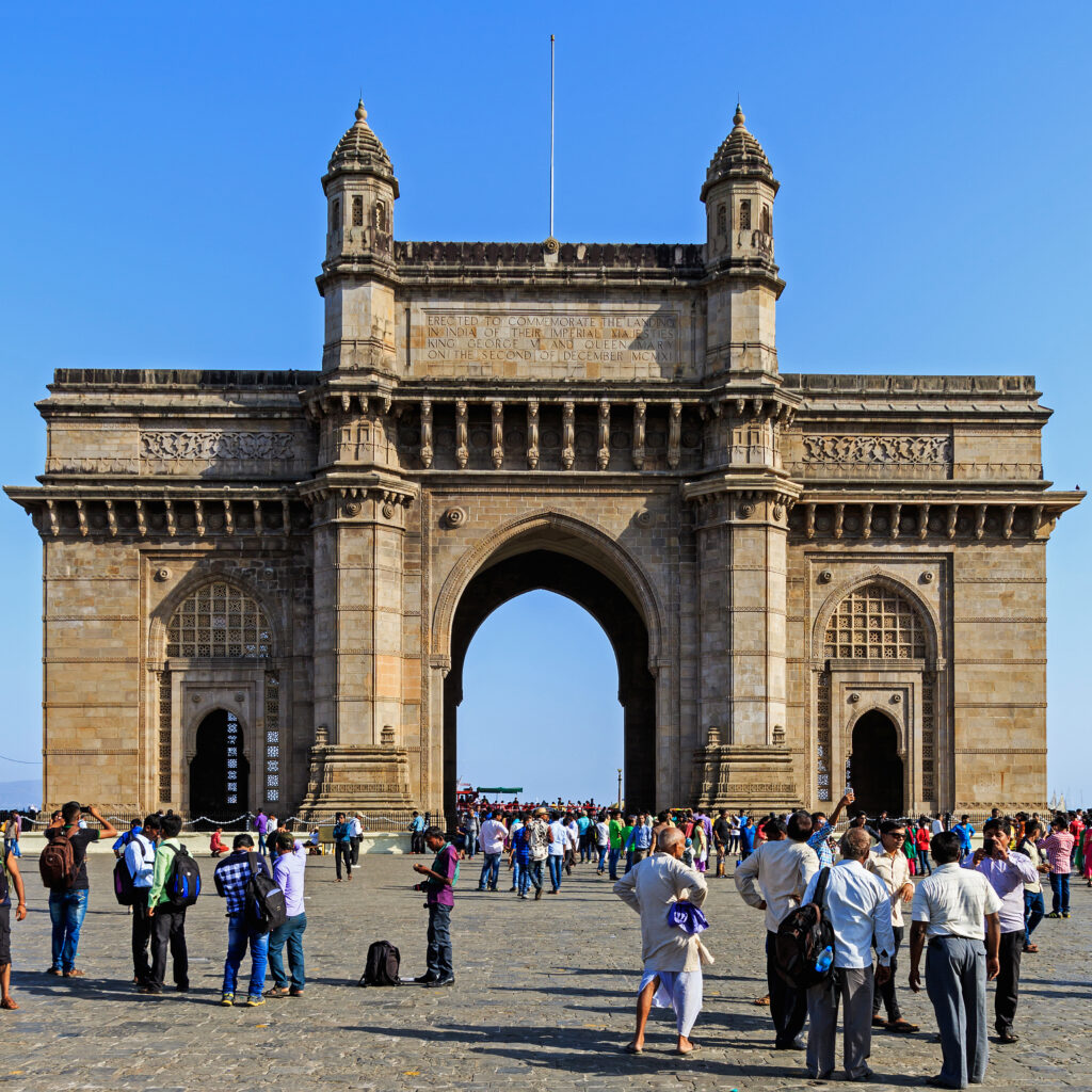
Image credit: A.Savin, Own work, licensed under FAL.https://en.wikipedia.org/wiki/Mumbai#/media
/File:Mumbai_03-2016_30_Gateway_of_India.jpg
- Name – MUMBAI (formerly bombay)
- Location – Maharashtra, West India
- Population – 2,16,73,000(approx )
- Area – 603 km2 (233 sq mi)
- Languages spoken – Marathi(official), English, Telugu, Hindi
- Timezone – IST (UTC+5:30)(UTC means coordinated universal time similar to GMT)
- History – Founded by Portuguese (1508), Bombay Presidency (1612-1947)British Colonial Era, renamed as mumbai in 1995
Mumbai – Infrastructure :
- GDP – 277 billion dollars (GDP means gross domestic product,means the total value of all final goods and services produced and sold in market typically in a year. )
- Key sectors – Finance, IT, Services, Manufacturing
- Finance – (35%)(related to banks, Real estate related)
- IT – (25%)(related to information technology, software related)
- Services – (25%) (everything other than IT, Finance, agriculture and manufacturing comes under service sector)
- Manufacturing – (20%)(manufacturing of machines ,electronic products etc .. )
- Major industries – Bollywood,Textiles, Pharmaceuticals, Automobiles
- Unemployement rate – 6.5% (2022)
- Literacy rate – 89.7 % (2024)
- Airport – Chhatrapati Shivaji International Airport (BOM)
- Ports – Mumbai port, Jawahar Lal Nehru port
- Metro – Mumbai Metro (335 km network)
- Railway Stations – Chhatrapati Shivaji Maharaj Terminus,Mumbai Central Railway Station (total over 40)
- Roadways – National Highways (3,4,8,17)
- Public transport – BEST(Brihanmumbai Electricity Supply & Transport) buses, Taxis, Auto rickshaws, Cycle rickshaws.
- Universities – University of Mumbai, Indian Institute Of Technology (IITB) (total around 20)
- Institutes – Indian Institute of Management (IIMM), National Institute Of Industrial Engineering (NITIE) (total over 100)
- Hospitals – Tata Memorial Hospital, Breach Candy Hospital, Lilavathi Hospital
- Medical Research – National Institute Of Technology (IITB), Haffkine Institute
- Health Care Infrastructure – 5500+ hospitals, 2500+ clinics
- Landmarks – Gateway Of India, Marine Drive,Chhatrapati Shivaji Maharaj Vastu Sangrahalaya
- Administrator – Mayor, Commissioner
- Municipal Corporations – Brihanmumbai Municipal Corporation (BMC)
- Climate – Tropical wet and dry climate
- Temperature range – 22 degrees (winter) to 35 degrees (summer)
- Monsoon season -June to September
- Population density – 21,000/km square
- Challenges – Housing shortage, Air pollution, over population, water scarcity, waste management, traffic congestion
5. HYDERABAD :
Hyderabad is the capital city of Telangana state, also known as “City of Pearls”
We have 8 Tier 1 cities in India, Hyderabad is one of them
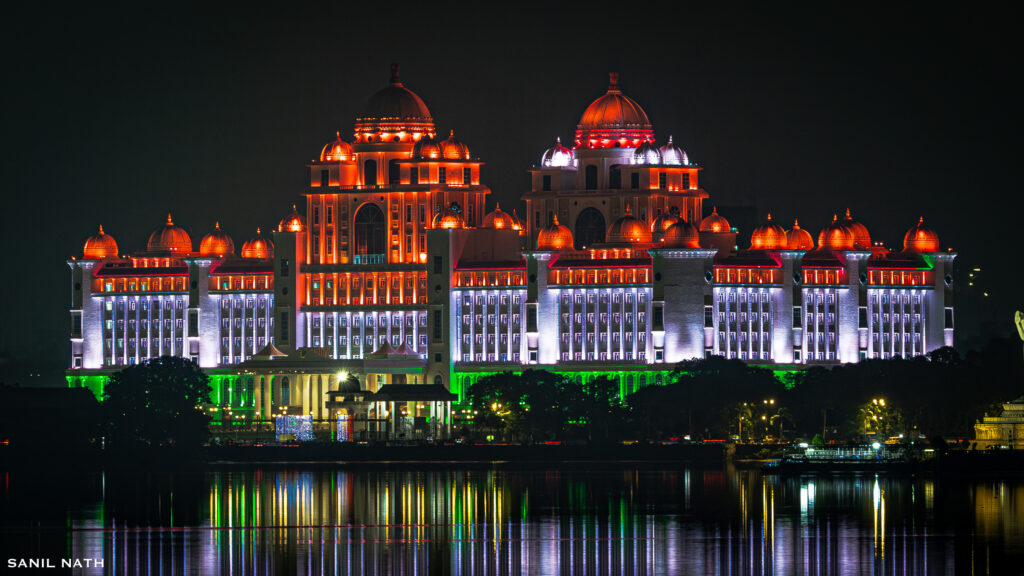
https://en.wikipedia.org/wiki/Hyderabad#/media/File:
Telangana_Secretariat.jpg
Image credit: Sanil Nath, Own work, licensed under CC BY 4.0.
- Name – HYDERABAD
- Location – Telangana, South India
- Population – 1,10,69,000(approx )
- Area – 650 km2 (251 sq mi)
- Languages spoken – Telugu(official), English, Hindi
- Timezone – IST (UTC+5:30)(UTC means coordinated universal time similar to GMT)
- History – Founded by Muhammad Quli Qutub Shah in 1591,Mughal era (1687-1724), Nizam era (1724-1948)
Hyderabad – Infrastructure :
- GDP – 200 billion dollars (GDP means gross domestic product,means the total value of all final goods and services produced and sold in market typically in a year. )
- Key sectors – IT, Pharmaceuticals, Services, Manufacturing
- IT – (40%)(related to information technology, software related)
- Pharmaceuticals – (20%)(Generic drugs, OTC medicines, Bulk drugs)
- Services – (20%) (everything other than agriculture and manufacturing comes under service sector)
- Manufacturing – (20%)(manufacturing of machines ,electronic products etc .. )
- Major industries – Technology, Biotechnology, Automobile, Textiles
- Unemployement rate – 7.1% (2023)
- Literacy rate – 82.9 % (2024)
- Airport – Rajiv Gandhi International Airport (HYD)
- Metro – Hyderabad Metro (66 km network)
- Railway Stations – Hyderabad Deccan Railway Station, Kacheguda Railway Station, Secunderabad Junction , 5 major stations, (Total around 15 stations)
- Roadways – National Highways (7, 9, 44)
- Public transport – TSRTC buses, Taxis, Auto rickshaws, Cycle rickshaws.
- Universities – University of Hyderabad, Osmania University and few more (total around 14)
- Institutes – Indian Institute of technology(IITH), Indian School Of Business(ISB), (total around 28 institutes)
- Hospitals – Apollo Hospital, Care Hospital, KIMS Hospital
- Medical Research – Indian Institute Of Chemical Technology(IICT), National Institute Of Nutrition(NIN)
- Health Care Infrastructure – 3000+ hospitals, 1500+ clinics
- Landmarks – Charminar, Golconda Fort, Qutub Shahi Tomb
- Administrator – Mayor, Commissioner
- Muncipal Corporations – Greater Hyderabad Municipal Corporation(GHMC)
- Climate – Tropical savanna climate
- Temperature range – 22 degrees (winter) to 40 degrees (summer)
- Monsoon season -June to September
- Population density – 15,571/km square
- Challenges – Air pollution, over population, water scarcity, slums, traffic congestion
6. KOLKATA :
Kolkata is the capital city of West bengal state, it is located on the Eastern bank of River Hooghly
We have 8 Tier 1 cities in India, kolkata is one of them
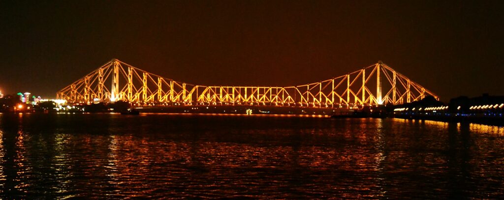
Image credit: Apoorva Karlekar, Own work, licensed under
CC BY-SA 4.0.
https://en.wikipedia.org/wiki/Kolkata#/media/File:
Howrah_bridge_at_night.jpg
- Name – KOLKATA (formerly Calcutta)
- Location – West Bengal, East India
- Population – 15,5,70,800 (approx )
- Area – 1854 km2 (716 sq mi)
- Languages spoken – Bengali (official), English, Hindi
- Timezone – IST (UTC+5:30)(UTC means coordinated universal time similar to GMT)
- History – Founded by British East India Company (1690), Capital Of British India(1772-1911) (British colonial era)
Kolkata – Infrastructure :
- GDP – 220 billion dollars (GDP means gross domestic product,means the total value of all final goods and services produced and sold in market typically in a year. )
- Key sectors – IT, Automotive, Services, Manufacturing
- IT – (25%)(related to information technology, software related)
- Agriculture – (25%)(Growing crops-fruits, vegetables etc)
- Services – (30%) (everything other than agriculture and manufacturing comes under service sector)
- Manufacturing – (20%)(manufacturing of machines ,electronic products etc .. )
- Major industries – Textiles, Jute, Tea, Engineering
- Unemployement rate – 7.1% (2023)
- Literacy rate – 87.5 % (2024)
- Airport – Netaji Subhas Chandra Bose Airport (CCU)
- Metro – Kolkata Metro (30 km network)
- Railway Stations – Howrah Railway Station, Sealdah Railway Station (total around 20 stations)
- Roadways – National Highways (2, 6, 34)
- Public transport – CSTC buses, Taxis, Auto rickshaws, Cycle rickshaws.
- Universities – University of Calcutta, Jadavpur University (total around 25 to 30)
- Institutes – Indian Institute of Management(IIMC), Indian Institute Of technology(IITKGP) (total around 100 )
- Hospitals – Apollo Gleneagles Hospital, SSKM Hospital
- Medical Research – Indian Institute Of Chemical Biology(IICB), National Institute of Cholera and Enteric diseases(NICED)
- Health Care Infrastructure – 2500+ hospitals, 1500+ clinics
- Landmarks – Victoria memorial, Indian Museum, Howrah Bridge
- Administrator – Mayor, Commissioner
- Muncipal Corporations – Kolkata Municipal Corporation(KMC)
- Climate – Tropical wet and dry climate
- Temperature range – 15 degrees (winter) to 35 degrees (summer)
- Monsoon season -June to September
- Population density – 25,250/km square
- Challenges – Air pollution, over population, Flooding, Poverty, traffic congestion
7. AHMEDABAD :
Ahmedabad is the largest city in Gujarat state
We have 8 Tier 1 cities in india, Ahmedabad is one of them
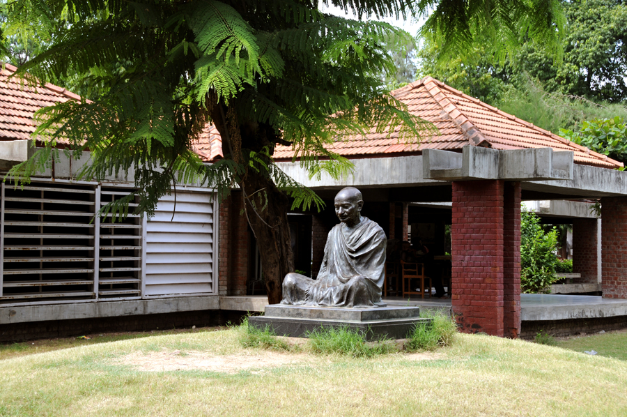
Image credit: Hardik Jadeja, Own work, licensed under
CC BY3.0.
https://en.wikipedia.org/wiki/Ahmedabad#/media/File:
Gandhi_Ashram.jpg
- Name – AHMEDABAD
- Location – Gujarat, West India
- Population – 88,54,444 (approx )
- Area – 464 km2 (179 sq mi)
- Languages spoken – Gujarati (official), English, Hindi
- Timezone – IST (UTC+5:30)(UTC means coordinated universal time similar to GMT)
- History – Founded by Sultan Ahmed Shah(1411),Mughal era (1572-1753), Maratha era(1753-1818), (1818-1947) (British colonial era)
Ahmedabad – Infrastructure :
- GDP – 136 billion dollars (GDP means gross domestic product,means the total value of all final goods and services produced and sold in market typically in a year. )
- Key sectors – IT, Textiles, pharmaceuticals, Manufacturing
- IT – (15%)(related to information technology, software related)
- Textiles – (30%)(Spinning, Weaving, Processing, Apparel manufacturing)
- Pharmaceuticals – (20%) (Generic drugs, OTC medicines, Bulk drugs)
- Manufacturing – (20%)(manufacturing of machines ,electronic products etc .. )
- Major industries – Cotton, Chemicals, Automobile, Engineering
- Unemployement rate – 4.4% (2023)
- Literacy rate – 88.2% (2024)
- Airport – Sardar Vallabhbhai Patel International Airport (AMD
- Metro – Ahmedabad Metro (40 km network)
- Railway Stations – Ahmedabad Railway Station, Gandhigram Railway Station (total around 10-12)
- Roadways – National Highways (8, 59, 147)
- Public transport – AMTS buses, Taxis, Auto rickshaws, Cycle rickshaws.
- Universities – Gujarat University, Ahmedabad University (total 15-20)
- Institutes – Indian Institute of Management(IIMA), Indian Institute Of Technology(DA-IICT) (total over 100)
- Hospitals – Apollo Hospital, Sterling Hospital, CIMS Hospital
- Medical Research – Indian Institute Of Technolology(IITGN), Gujarat Cancer Research Institute
- Health Care Infrastructure – 2000+ hospitals, 1000+ clinics
- Landmarks – Sabarmati Ashram, Akshardham Temple, Adalaj Vav
- Administrator – Mayor, Commissioner
- Muncipal Corporations – Ahmedabad Municipal Corporation(AMC)
- Climate – Semi Arid climate
- Temperature range – 12 degrees (winter) to 43 degrees (summer)
- Monsoon season -June to September
- Population density – 10,150/km square
- Challenges – Air pollution, over population, water scarcity, slums, traffic congestion
8. PUNE :
Pune city is in the state of maharashtra state, also known cultural capital of Maharashtra state is also one of the tier1 city in India
We have 8 Tier 1 cities in India, Pune is one of them
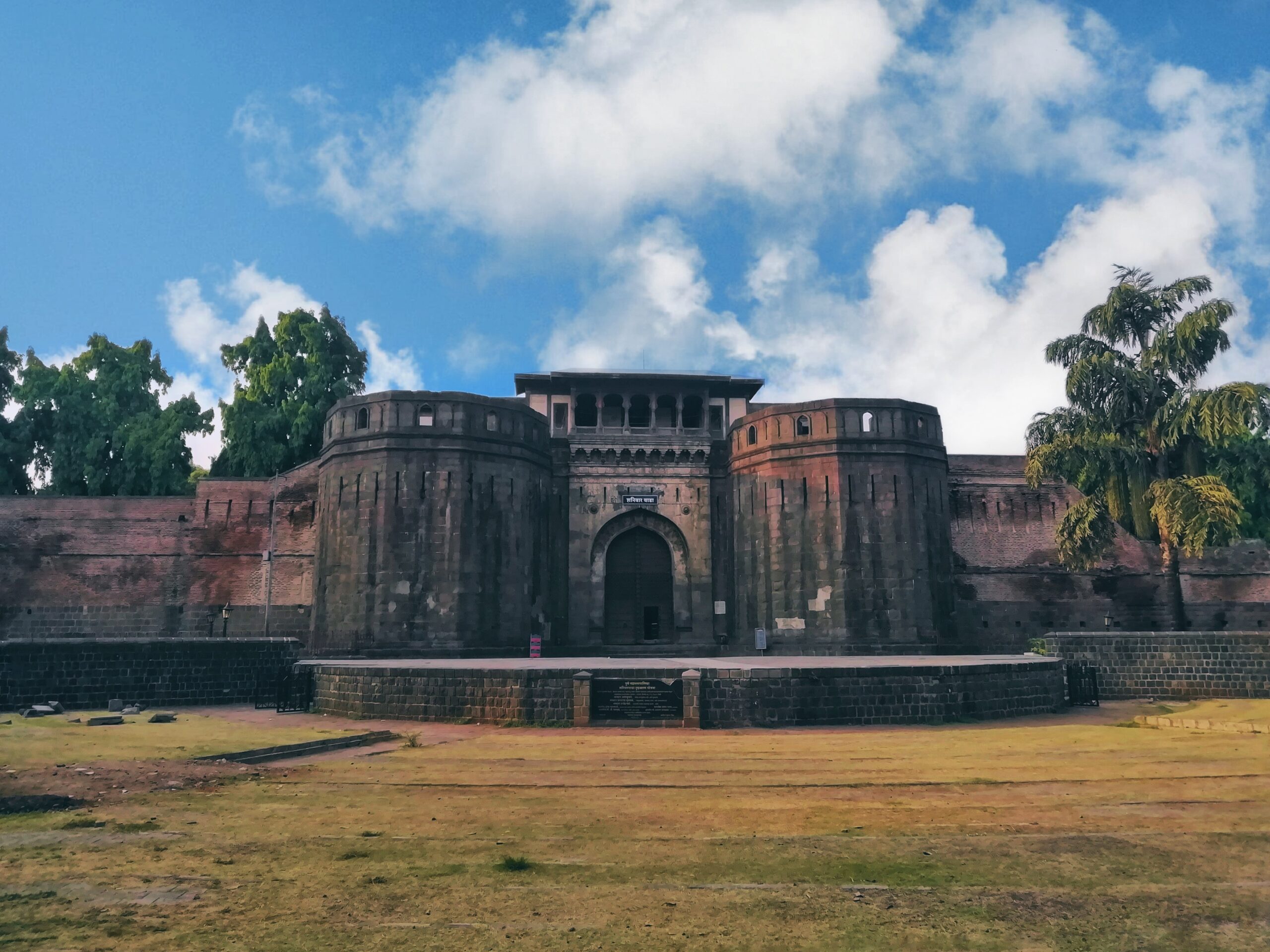
Image credit: Rohan Sandeep Pawar, Own work, licensed under CC BY-SA 4.0.
https://en.wikipedia.org/wiki/Pune#/media/File:
Shanivar_Wada,Pune.jpg
- Name – PUNE
- Location – Maharashtra, West India
- Population – 1,22,90,000 (approx )
- Area – 729 km2 (281 sq mi)
- Languages spoken – Marathi(official), English, Hindi
- Timezone – IST (UTC+5:30)(UTC means coordinated universal time similar to GMT)
- History – Founded by Rashtrakuta dynasty (937 AD), Mughal era(1636-1707), Maratha era(1707-1818),(1818-1947) (British colonial era)
Pune – Infrastructure :
- GDP – 69 billion dollars (GDP means gross domestic product,means the total value of all final goods and services produced and sold in market typically in a year. )
- Key sectors – IT, Automotive, Education, Manufacturing
- IT – (35%)(related to information technology, software related)
- Automotive – (25%)(manufacturing of vehicles 2-wheelers, 3-wheelers,passenger cars, light commercial vehicles, trucks, buses, tractors, heavy commercial vehicles)
- Education – (20%) (Primary, Secondary, Higher, Vocational education)
- Manufacturing – (20%)(manufacturing of machines ,electronic products etc .. )
- Major industries – Software, Automobile, Engineering, Pharmaceuticals
- Unemployement rate – 3.9% (2023)
- Literacy rate – 89.6 % (2024)
- Airport – Pune International Airport (PNQ)
- Metro – Pune Metro (54 km network)
- Railway Stations – Pune Railway Station, Shivaji Nagar Railway Station (total 10-12)
- Roadways – National Highways (4, 9,48)
- Public transport – PMPML buses, Taxis, Auto rickshaws, Cycle rickshaws.
- Universities – Savitribai Phule Pune University, Pune University (total around 15)
- Institutes – Indian Institute of Technology(IITP), National Defence Academy(NDA) (total around 100)
- Hospitals – Apollo Hospital, Jehangir Hospital, Ruby Hall Clinic
- Medical Research – National Institute Of Virology (NIV)
- Health Care Infrastructure – 1500+ hospitals, 500+ clinics
- Landmarks – Shaniwar Wada, Aga Khan Palace, Pune Vishrambag Wada
- Administrator – Mayor, Commissioner
- Muncipal Corporations – Pune Municipal Corporation(PMC)
- Climate – Tropical savanna climate
- Temperature range – 12 degrees (winter) to 35 degrees (summer)
- Monsoon season -June to September
- Population density – 7,800/km square
- Challenges – Air pollution, over population, water scarcity, slums, traffic congestion


Good Information
👍